Professional Drone Services
Combining high-quality images with software solutions for enhanced project insights.
Features
-

Quick turnaround of visual data; recorded in HQ formats.
-
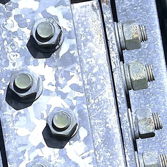
Enhanced zoom functionality where components are far away.
-
Gain access to hard-to-reach areas.
-
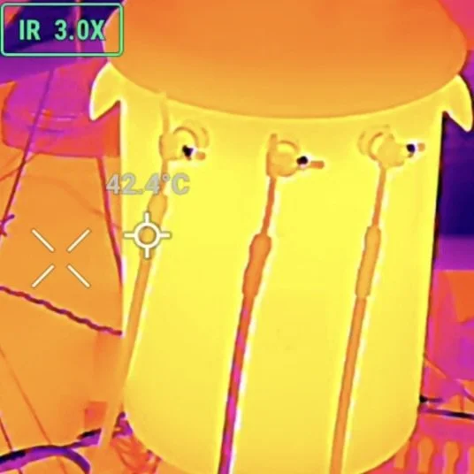
Thermal Imaging available as a spot meter or an area measurement.
-
Develop Project insights from meta data.
-

Integrate data into your existing maintenance plans.
Frequently Asked Questions
-
Visual data can be used to make informed decisions that require estimates of spatial dimensions, gain access to hard-to-reach areas, and evaluate thermal efficiencies. It is also cost-effective and can minimize the risk of exposure to personnel.
-
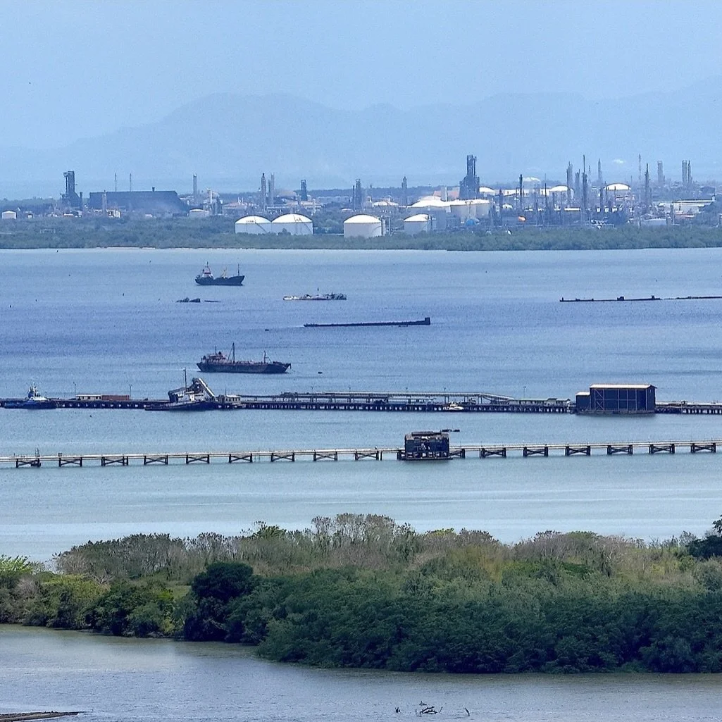
Oil, Gas & Energy Sectors, Civil Engineering, Land Development, Construction Sector, Surveying, Public Utilities and more.
-
Trinidad & Tobago
-
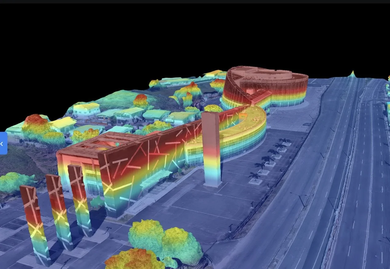
High-quality images and video recordings, photogrammetry, 3D mapping, thermal imagery, visual inspections and reports, search and rescue operations.
-
The operations are compliant with both the Trinidad & Tobago Civil Aviation Authority (TTCAA) and the US Federal Aviation Administration (FAA) regulations; and follow the guidelines of the Telecommunications Authority of Trinidad & Tobago.
-
Connect with us via our Contact Us page. We’ll reach out to determine the limits of the scope of work and schedule a site visit to develop a proposal that works for you.

US FAA Certified

LEAN6σ Practices

TTCAA UAS Registered